Here’s a detailed description:
- Saline Wedge:
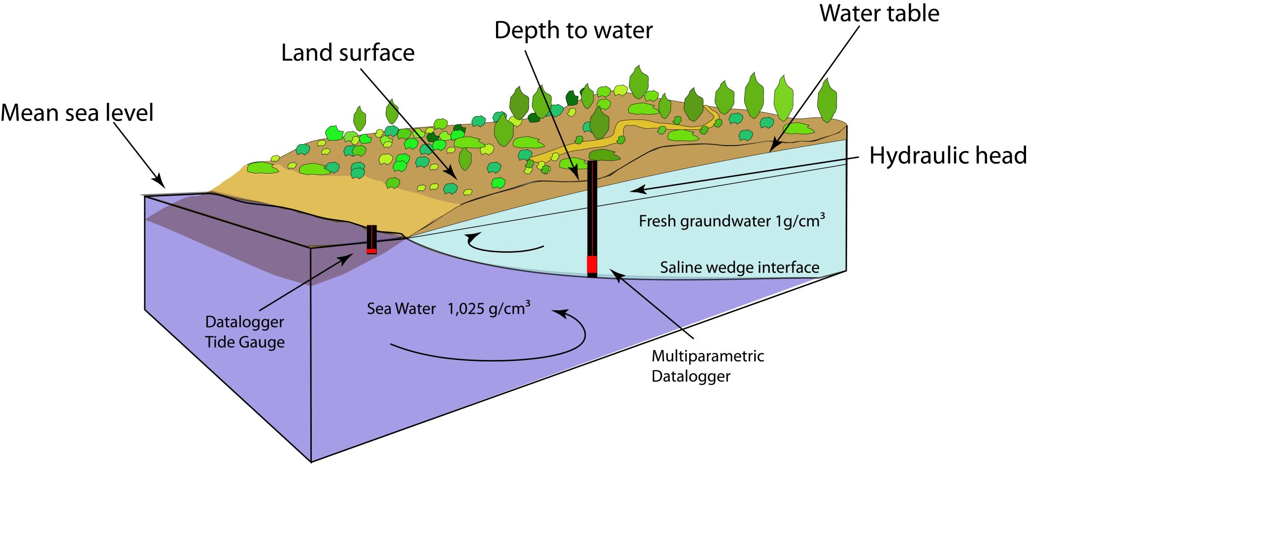
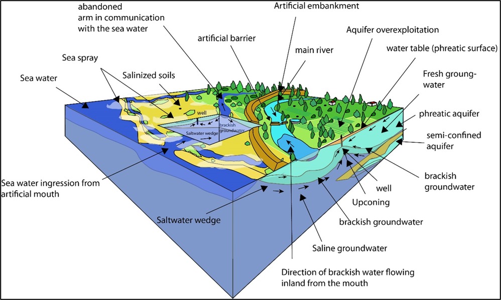
- The saline wedge is a hydrogeological feature characteristic of coastal aquifers, where denser seawater (1.025 g/cm³) intrudes into the subsurface, forming a balance with less dense freshwater (1 g/cm³).
- The transition zone between freshwater and saltwater is called the “saline interface.” The position of the saline wedge is influenced by the hydraulic head of freshwater, sea level, and soil properties.
- Components of the Image:
- Mean Sea Level: Acts as the altimetric reference point to assess the relationship between the saline wedge and freshwater.
- Land Surface: Depicts the coastal topography, including vegetation and surface features.
- Water Table: Represents the upper boundary of the freshwater within the aquifer.
- Hydraulic Head: Indicates the pressure gradient driving freshwater flow towards the sea.
- Multiparametric Datalogger: Devices installed in the aquifer to monitor parameters such as salinity, temperature, and water table depth. They provide continuous and detailed observations of the system’s dynamic changes.
- Monitoring of the Saline Wedge:
- Tide Gauge/Datalogger: Located near the sea, this instrument measures tidal levels and monitors sea level fluctuations that influence the saline wedge’s position.
- Multiparametric Datalogger: Positioned in boreholes within the aquifer, it tracks the saline interface’s location, water depth, and relative density (salinity).
- Data collected by these tools help understand the interactions between freshwater and saltwater and evaluate the impacts of events like climate variations, groundwater extraction, or sea level rise.
- Hydrodynamic Processes:
- The saline wedge advances or retreats depending on the balance between freshwater flow from inland and the pressure of seawater intrusion.
- The structure shown in the image depicts a system where density gradients and hydraulic head govern the wedge’s behaviour
|